Since ancient times, people have tried to develop various methods with which to precisely determine where they were on the surface of the Globe. The need for precision has become all the more important as travel for various reasons to all corners of the planet has multiplied and become faster. Over time, several attempts were made to create a more accurate system, but insufficient technological development meant that they did not become really useful until the second half of the 20th century when space technology, in especially of artificial satellites, has allowed the evolution of a system that meets basic requirements with regard to the highest possible accuracy.
In the article below you will discover what GPS means and what is the history of the implementation of this mode of orientation on the map. You will also find out what are the operating principles of the system and what are its practical applications, as well as what other types of global navigation with the help of satellites currently exist.
1. What is GPS?
GPS is a global positioning system, which manages through a significant number of satellites to provide users with extremely accurate positioning. The name of the system comes from the words Global Positioning System, which in English means global positioning system. GPS has its beginnings in the 70s of the last century, when the US military developed a method to extremely accurately determine the geographical location of an object by determining its latitude, longitude and altitude.
1.1. Implementation of the GPS system
The first attempts at a global positioning system using satellites were made in the 1960s, when the US Navy conducted the first tests of establishing position using signals transmitted by satellites orbiting the Earth. The system, called Transit, had limited results because it had limited coverage and positioning updates at long intervals of about an hour.
A merit of the system was, however, the proof of the practicability of the method, which led to the fact that in 1974 the US Department of Defense initiated the creation of a much more complex system, available all over the Earth, a system that received the name GPS NAVSTAR. Between 1978 and 1983 the system was used only for military purposes, after this date the satellite signals could also be used for civilian purposes.
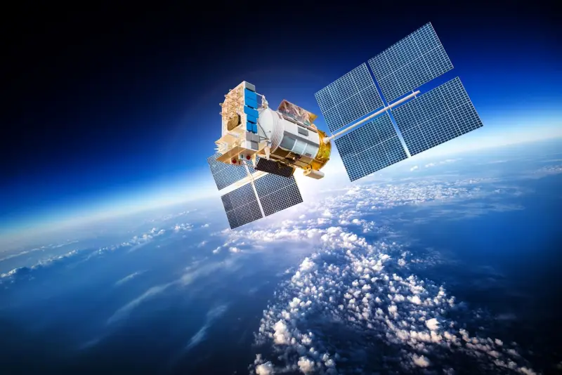
From 1978 until now, American rockets have placed in orbit a number of 72 satellites of various models, of which 31 are still active today:
- Block I model – 11 satellites used for system testing;
- The Block II model – was represented by 9 satellites that offered increased precision due to the 4 atomic clocks present on each component of the system;
- Block II A – 19 satellites that also had the possibility of communicating with each other to increase positioning accuracy;
- Block II R – 12 satellites equipped with much higher precision atomic clocks;
- Block II R-M – 8 satellites that allow creating a stronger signal, suitable for high-precision civil applications;
- Block II F – 12 satellites with a longer lifespan and with the possibility of transmitting a new type of signal for civilian use;
- Block III – 12 satellites incorporating the latest developments in space technology.
1.2. The working principle of the GPS system
The principle of operation of the system is based on the emission of an electromagnetic signal by each of the satellites that make up the system and the reception and interpretation of the data by a user by means of a special device. Through the use of the triangulation method, precisely knowing the transmission speed of electromagnetic radiation equal to the speed of light can be established by calculating extremely precisely the time required to travel the distance from the satellite to the device.
Through the simultaneous use of signals transmitted by at least 4 satellites (three for the actual calculation and one for control) the geographic position can be triangulated. The system’s coverage is global, so users anywhere on the globe can use the transmitted signals to pinpoint where they are.
For the proper functioning of the system, it consists of three different components:
- The space component, made of 24 satellites placed at an altitude of approximately 20,000 km and revolving around the planet in precise orbits, once every 12 hours;
- The control component, consisting of 5 control centers with the role of monitoring the proper functioning of the system and intervening if necessary;
- The user component, represented by the hundreds of millions of devices that can receive signals transmitted by satellites. These devices, either in the form of dedicated ones or in the form of mobile phones that have a special antenna for receiving the signal, are used both by the US military and by various organizations and private individuals.
1.3. Advantages and disadvantages of the GPS system
Started as a military system, today GPS is a system that offers many advantages for a diverse range of activities. These advantages include:
- Global coverage of the system (satellites are positioned in such a way that, at any moment, at least 3 satellites are in the range of transmitting and receiving the signal, regardless of where the user is located);
- The GPS system provides free signal to the users, which means that they will not have to pay an additional fee to enjoy its advantages;
- The signal can be integrated into an extremely wide range of applications, such as traffic guidance for automobiles, precision navigation of aircraft and ships, calculating the altitude of a specific point, measuring distances in a highly accurate way, obtaining directions to various places such as restaurants, banks, gas stations or even finding lost people in various isolated places.
There are indeed some disadvantages to the system, especially considering its military purpose, which makes civilian use of secondary interest:
- The US military can limit location learning or even block the system entirely at any time if deemed necessary;
- The signal does not work inside buildings or in areas with significant physical obstacles to the electromagnetic signal;
- Certain atmospheric phenomena can prevent the correct transmission of the signal;
- Reception systems work on the basis of electric current, so the devices must be connected to a continuous source, the lack of which makes it impossible to determine the location.
2. Practical applications of the GPS system

The potential of the system is extremely high, its applications being more and more numerous, considering the availability of signal receiving devices, which are smaller and smaller in size, consume less energy and are affordable.
2.1. Military applications of GPS
GPS technology arose for military reasons, with the US military needing a tool that could locate an object with high precision. This feature allows military users to benefit from indispensable services such as:
- Navigation. Military vehicles and soldiers can precisely orient themselves in unfamiliar areas, which facilitates the coordination of troops and the supply of ammunition, food, other military equipment;
- Precise targeting with guided weapons. It allows the achievement of pinpoint shots;
- Guidance of missiles or other projectiles that have built-in GPS receivers;
- Search and rescue of soldiers in difficult situations;
- Monitoring nuclear detonations globally.
The system first proved its value in 1991 during the Iraq War, when the US military was extremely successful, much of the credit for the victories being due to the high technologies used in the conduct of the war.
2.2. Civil applications of GPS
The GPS system is a dual one, which means that civilians can also access the signals transmitted by the satellites launched into space by the US military. Currently there are dozens of fields that enjoy the immense advantages that global positioning offers. The system offers three important elements in this respect, namely precise location, motion recording and exact time duration between two landmarks.
By using the three advantages, civilians can enjoy various applications, such as:
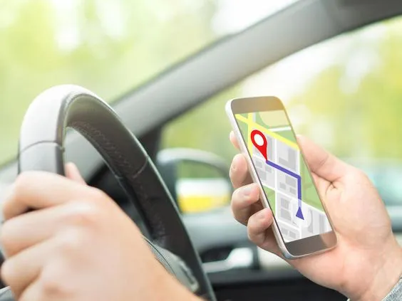
- Precise navigation, in real time, which allows the use of digital maps with global coverage (There are devices dedicated to navigation in this sense, but also applications that work on modern mobile phones, which have built-in GPS modules);
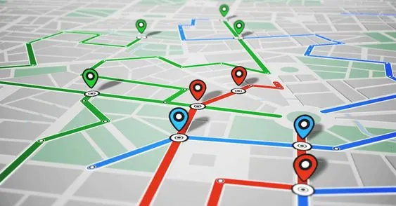
- Fleet monitoring via GPS. The vehicles of a commercial fleet can be tracked in a very accurate way through a monitoring system that captures the route taken, the time spent in traffic and the speed of the vehicles, which provides extremely useful data that can be used to achieve significant savings, up to 30% of total costs;
- The development of autonomous vehicles that do not require the presence of a driver and that can reach any place on the Globe by themselves;
- Establishing the positioning of aircraft;
- Accurate mapping;
- Synchronization of clocks with extreme accuracy;
- Solving urgent situations, such as accidents or various natural disasters;
- Recreational use (Games based on geographic location);
- Geocaching;
- In sports.
The value of a global positioning system is obvious, in this sense the GPS system is a real trailblazer. The fact that the satellite network is owned by the United States military means that the signal is limited, both in terms of its accuracy and use in various sensitive areas. This reality has led other states or organizations to develop their own systems to avoid being at the mercy of the US military:
- GLONASS is a satellite navigation system developed by the Russian state. It has capabilities similar to the GPS system, both in terms of global coverage and positioning accuracy. The system was inaugurated in 1976 with the launch of the first satellite of the constellation. It currently has 24 satellites, which allows the signal to have full coverage. It is true that the accuracy is higher in the northern latitude area due to the way the satellites are placed;
- Galileo is a global satellite navigation system created by the European Union through the European Space Agency. The system is civil, free and available non-stop, without the possibility of signal alteration, as in the case of the GPS system or the GLONASS system. The system operates through 24 operational satellites, plus 6 spares already in orbit. Of these, 22 are already operational, transmitting a signal to a diverse range of users, individuals, legal entities or even scientists;
- Beidou is a Chinese positioning system that debuted in 2000 with the launch of three satellites, with coverage only over China and surrounding areas. In the last 20 years the constellation of satellites has grown, reaching now to have global coverage. The accuracy of the system is between 2.6 meters and 3.6 meters for the general public and 10 cm for military applications;
- NavlC is conducted by Indian state with coverage in India and Indian Ocean area. The system includes 8 satellites that offer a precision between 1 and 3 meters for the public and 10 cm for military applications;
- QZSS is owned by the Japanese government and consists of 5 satellites already in orbit, with two more soon to be added. Coverage is limited in the Japan and Australia area.
The states involved in the realization of positioning systems with the help of satellites plan to modernize them by launching more powerful satellites, which will allow extraordinary accuracy, necessary for modern applications.
In conclusion, the GPS system is an extremely useful aid for a wide range of users who can enjoy the advantages offered for free. More and more fields incorporate the use of applications that work on the basis of the GPS signal to make work more efficient and to allow various activities to be carried out safely.